
How Is Drone Photography Revolutionizing Tourism in Richmond VA?

Updated: Oct 4
Drones have changed how a lot of industries show off what they do, and tourism is right near the top of the list. Richmond, VA is a great example. Put a camera a few hundred feet up over this city and you see it in a way you just can't from the sidewalk. Here's how that's playing out.

What Makes Richmond, VA a Perfect Candidate for Drone Photography?
Richmond has a lot going for it from above. You've got historic buildings, the James River cutting through town, and a nice mix of tight urban blocks and green space. Fly over the river at the right time of day and you catch the skyline reflecting in the water. That's the kind of shot that makes someone stop scrolling and actually look.
The history helps too. Landmarks like the Virginia State Capitol and Saint John's Church read completely differently from the air. You get the scale, the setting, the way they sit in the neighborhood around them. Ground photos just can't show that, and it's a big part of what pulls history-minded visitors in.
Drones aren't only good for pretty pictures, either. They're handy for keeping an eye on the parks and natural areas around the city, giving a fresh angle on the spaces that make Richmond what it is. You get the good-looking side and the practical side out of one tool.
How Drone Photography Enhances Tourist Experiences
Think about scoping out Richmond from the sky before you ever show up. Drone footage lets people preview the city, so a trip starts to feel real before anyone books a hotel. Virtual tours built from aerial clips do a lot of that work.
It's practical, too. A quick aerial pass shows how places like the Lewis Ginter Botanical Garden or the Carytown shopping strip are laid out, so folks can plan their day. And seeing all that green from above tends to nudge people toward one more hike or an afternoon in the park.
Where Aerials Shine Across Richmond
Richmond is a city of neighborhoods, and each one reads differently from a couple hundred feet up. Scott's Addition shows off the old warehouse rooflines and the breweries that moved into them. The Fan stretches out in those long rows of painted row houses that only really make sense from above. Church Hill gives you Saint John's and the view back toward downtown, and Manchester's newer builds sit right across the water from the skyline. Follow the James near Belle Isle and you catch the rapids, the old rail bridges, and the tree line in one frame.
Timing matters as much as location. Spring brings the dogwoods and redbuds, so a pass over a leafy block looks its best in April. Fall along the river is the money season, when the tree cover turns and the water goes dark and deep. Even winter earns its keep. Bare trees let you show a building's full footprint and roofline, which is exactly what you want on a property listing when summer leaves would hide half the structure.
The Role of Drone Photography in Marketing Richmond
For anyone promoting the city, aerial shots are hard to beat. Tourism groups and local businesses lean on that eagle-eye view to make ads and social posts that actually land. It's the same reason it works so well for promoting small businesses.
A good aerial tells a story that a paragraph of copy or a flat photo can't. Show someone Richmond's skyline or a historic block from above and you make the kind of connection that makes them want to see it in person.
For a local shop or restaurant, the same approach pays off. Capture the feel of the place and the area around it, and you pull in more foot traffic while making the whole city look like somewhere worth a visit.
For Agents and Brokers, Not Just Tourism Boards
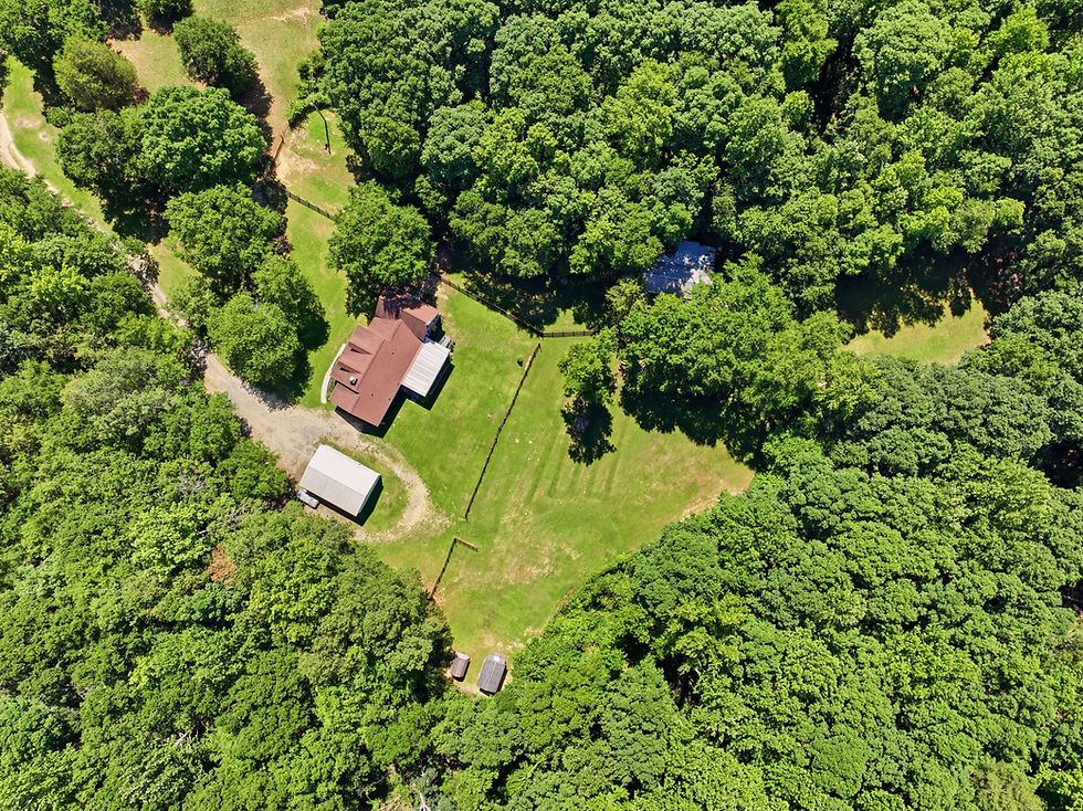
Tourism boards get a lot of the attention here, but the same aerials do real work for anyone selling property in Richmond. A listing with a clean overhead shot shows the lot lines, the yard, and how close the good stuff is, the park, the river, the highway on-ramp. Commercial buildings get the same lift, since a broker can show the parking, the loading access, and the neighboring tenants in a single frame. If you handle office, retail, or industrial space, we put the whole playbook together in our guide to commercial real estate photography in Richmond.
Challenges and Considerations in Using Drones for Tourism
Flying isn't a free-for-all, though. There are no-fly zones, privacy to respect, and safety rules to follow, especially in busy spots full of visitors. A good operator knows where they can and can't fly and plans around it.
The rules move too. Any drone flown commercially has to broadcast Remote ID now, and the airspace grids around Richmond International get revised from time to time, so an authorization that worked last season is not automatically the one that applies this season. Tracking that is the operator's job rather than yours, but it is a fair thing to ask about before you hand someone a shoot.
Handle all that the right way and drones can do a lot for Richmond tourism. Stay on top of the rules, keep learning, and you get the upside without the headaches.

Flying Legal in Richmond
Here's the part a lot of people skip. Richmond International sits just southeast of downtown, and a good chunk of the metro falls inside its controlled airspace. That means a compliant operator pulls LAANC authorization before a flight instead of just launching. Add in the Part 107 rules every commercial pilot works under, temporary flight restrictions around big events, and the plain courtesy of not hovering over a crowd on Brown's Island, and you can see why the planning matters. A pilot who knows the local airspace saves you the headache and the fine.
Before an aerial job in the city, we line up a few things:
LAANC authorization for the controlled airspace around Richmond International, filed ahead of time.
A check for temporary flight restrictions, since events downtown and along the river pop up often.
A flight plan that keeps the drone off people and busy roads, especially in tight spots like Carytown or Scott's Addition.
A charged set of batteries and a real weather window, because summer storms here roll in fast.
The Future of Drone Photography in Richmond
What an Aerial Shoot in Richmond Actually Involves
The flying part is short. For aerials alone we're usually on site 30 to 45 minutes, weather permitting. A standard set runs 8 to 12 edited stills plus a short video pass. On a listing that means the four compass exteriors, one high overview that shows the lot and how it meets the street, and a couple of angles pointing at whatever the selling feature is, whether that's the river, a park, or easy access to 64. Edited files come back the next business day, and video usually the day after that.
The part that takes longer is everything before the batteries go in. Airspace check, weather window, and a walk of the property to figure out where the drone can launch and land safely. On a tight block in the Fan that can be the hardest problem of the day.
How to Vet an Operator Before You Book
Three questions will tell you most of what you need to know.
Ask for the Part 107 certificate and a current insurance certificate. A working commercial pilot will have both ready and will not be offended that you asked.
Ask whether they file LAANC themselves or subcontract the flying. If they cannot answer plainly, they are probably subcontracting.
Ask to see aerials they shot inside the metro, not a general reel. Local airspace competence shows up in the work, because a pilot who knows the area gets the angle without fighting the restrictions.
The same standard applies to the ground work that goes with it. If aerials are one piece of a full listing package, it's worth reading how the rest of the shoot should come together in our 2026 listing playbook for South Carolina and Virginia.
When an Aerial Is Not the Right Spend
Aerials are not automatic. On a narrow Fan lot with houses shoulder to shoulder and no yard to speak of, a drone shot mostly shows the neighbors' roofs and the alley. Condo and townhouse units are similar, since the thing you're selling is inside and the building already looks like every other building on the block. If the weather window is bad, a rushed aerial in flat grey light does less for a listing than nothing at all. In those cases the money goes further on twilight exteriors, a floor plan, or simply more interior coverage. A photographer who tells you that instead of upselling you is one worth keeping.
Drone photography has already changed how people see Richmond, and it keeps growing. It makes the city look great, helps visitors plan, and hands local businesses and agents a real edge. If you want to work aerial shots into your own marketing, reach out to Beyond All Media. Call us in Richmond at (804) 913-3013 or over in the Carolinas at (864) 714-0724.


Comments