
How is Drone Technology Revolutionizing Construction Photography?

Updated: Oct 4
Drones have changed a lot of trades in the last few years, and construction photography is near the top of the list. Here's how they're reshaping the way we document a build, what a shoot day actually involves, and what to expect if you're bringing one onto a site in South Carolina or Virginia.

What Role Do Drones Play in Construction Photography?
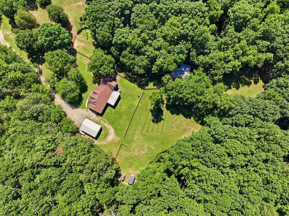
Drones give you angles that used to be flat-out impossible. You can shoot a whole site from above, follow progress over time, and hand stakeholders a clear view of where things stand. Hovering over a job, a drone grabs the kind of overhead look that's perfect for planning and check-ins, and it keeps everyone on the same page.
It's more than pretty pictures, though. Pair a drone with photogrammetry or thermal imaging and you get real data about site conditions and progress. That feeds into detailed maps and 3D models, and the right software turns all that aerial footage into something a team can actually act on.
On busy sites where a lot is happening at once, drones stay out of the way. They capture photo and video without stopping the crew, so your documentation keeps pace with the work and the project stays on schedule.
The other thing drones changed is cadence. A high-angle progress photo used to be a production, so you got one at groundbreaking and maybe one at topping out. Now a monthly or biweekly flight is cheap enough to build a real timeline. Same altitude, same flight path, same time of day, month after month. Lined up side by side, those frames become the clearest progress record a project has, and they settle a lot of arguments about when something actually got built.
What a Construction Drone Shoot Looks Like
Most of our construction flights run 45 minutes to a couple of hours on site, depending on the footprint and whether the client wants video. We start by walking the perimeter and noting anything we need to fly around: cranes, power lines, active lifts, neighboring rooftops. Then we set the flight plan and go up.
The deliverable usually breaks into a few buckets, and it helps to know which ones you actually need before you book.
Progress stills. Fixed overhead and oblique angles, repeated on the same path every visit so the images stack into a timeline.
Hero shots. The marketing frames. Golden hour, wide, the ones that end up on the website and in the pitch deck once the job is done.
Survey and mapping passes. Grid flights that feed photogrammetry software and turn into orthomosaics, point clouds, or 3D site models.
Video. Short orbit and flyover clips for owner updates, investor reels, or social.
Most projects need the first two. The mapping passes earn their keep on larger sites or when the GC wants measurable data instead of pictures, and they take longer in the air and a lot longer in post.
Advantages of Using Drones Over Traditional Methods
Compared to the old way, drones are cheaper, faster, and they shoot in high resolution. You're not renting cranes, scaffolding, or lifts for a high-angle shot anymore. One drone covers the whole site in minutes with a fraction of the crew.
They also reach the spots you can't, or shouldn't, get to by hand. That opens up more angles and more complete coverage, from capturing the whole landscape to zooming in on one structural detail, without a bunch of expensive setup.
We lean on that speed and accuracy in our own work. Once a site's mapped with drone data, teams can run scenarios, check structural details, and make calls with less guesswork. It's a better way to work, and the results show it.

How Do Drones Enhance Safety in Construction Photography?
Safety comes first on any site, and drones help a lot here. They keep photographers off the dangerous spots by flying the tricky terrain and high elevations instead. Nobody's climbing where they don't need to be.
You can survey a whole site without putting anyone at risk, and the real-time data makes it easier to spot hazards and plan around them before they turn into a problem. Less exposure, fewer accidents, same quality shots.
Airspace and Permissions in South Carolina and Virginia
This is the part that catches people off guard. A commercial drone flight in the US needs an FAA Part 107 certified pilot, and a lot of the places we work sit inside controlled airspace where that pilot also needs an authorization before the drone leaves the ground.
In the Upstate, anything close to Greenville-Spartanburg International falls under GSP's Class C shelf, and Donaldson Field plus the smaller Anderson and Spartanburg fields have their own footprints. Columbia has the same situation around CAE. In Richmond, RIC's Class C reaches over a good chunk of the east side, and the restricted airspace near downtown adds another layer. Most of these clear through LAANC in a few minutes. Some grids require a manual request that can take days or weeks.
The practical takeaway for a builder: have your operator check the airspace at booking, not the morning of the shoot. A flight that needed a manual waiver and didn't get one is a flight that doesn't happen, and rescheduling around concrete pours and crane time is nobody's idea of a good week. A short checklist before you book:
Confirm the operator holds a current FAA Part 107 certificate.
Ask for a certificate of insurance naming the project. Most GCs require it anyway.
Get the airspace check done at booking so any manual authorization has time to clear.
Share the site plan and any crane or lift schedule so the pilot can plan around them.
Decide up front whether you need mapping data or just photos. It changes the flight time and the price.
Integrating Drone Technology into Construction Projects
Bringing drones onto a project means handling the regulations, having skilled pilots, and planning it out. At Beyond All Media, that's the part we take seriously. Our pilots know how to read different site conditions and they know the rules cold, so every project gets the upside without the headaches.
There's a sustainability angle too. Drones can run long aerial surveys with barely any footprint, mapping terrain and tracking resources while keeping everyone in the loop. That's good for the environment and good for collaboration between teams.
Our whole job is turning what a client pictures into something they can actually see. Drones push past the old limits of construction photography, and as projects get more complex, that aerial view only gets more useful.
Where Construction Photography Is Headed
Drones have changed construction photography for good. New angles, faster work, safer sites. As the field keeps moving, they're only going to become more of a default tool for capturing a job. If you want the longer version, here's how drone photography is reshaping construction in South Carolina. Ready to get your project in the air? Reach Beyond All Media in the Carolinas at (864) 714-0724 or in Richmond at (804) 913-3013.


Comments