
What a drone shot actually proves on an Upstate subdivision listing
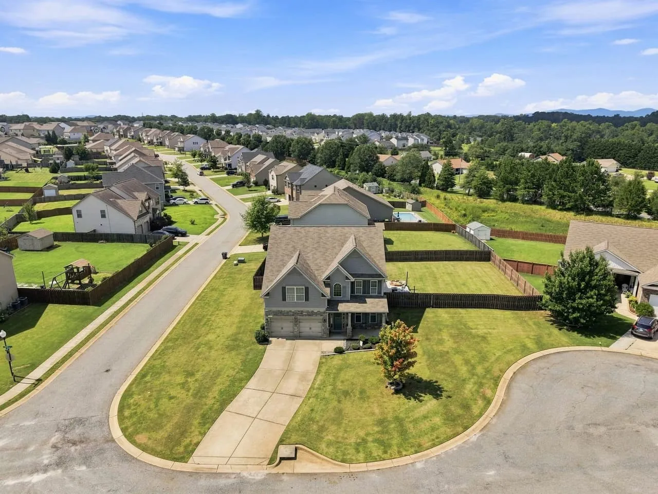
Your seller has a nice house on a third of an acre in Lyman. Three bedrooms up, a fenced backyard, a cul-de-sac out front. No lake, no pasture, no mountain view off the back deck. So you’re building the order, you get to the aerial add-on, and it’s fair to wonder whether that money would do more as a floor plan.
Drone coverage sells itself on acreage. The land is the product, so of course you shoot the land. The broader case for aerial work on Upstate listings is its own subject. This is the narrower question: the ordinary lot, in the ordinary subdivision, and what you actually get for the money.
The questions an aerial answers that your interiors can’t
Pull up a half-acre listing in Duncan or Boiling Springs and read the agent-to-agent emails that come in. They’re almost always the same four questions.
- How close is the house next door, really.
- Is the backyard flat, and how much of it is actually usable.
- What’s behind the property. Treeline, retention pond, the back of a shopping center, another row of roofs.
- Where does the lot end.
A 16mm interior shot can’t answer any of those, and a ground-level exterior only half answers the first one. One aerial answers all four at a glance. It matters more for a buyer relocating along the I-85 corridor, say for a job in Greer or Greenville. They’re assembling a picture of your neighborhood from several states away, on a phone, at night.
Three frames do most of the work
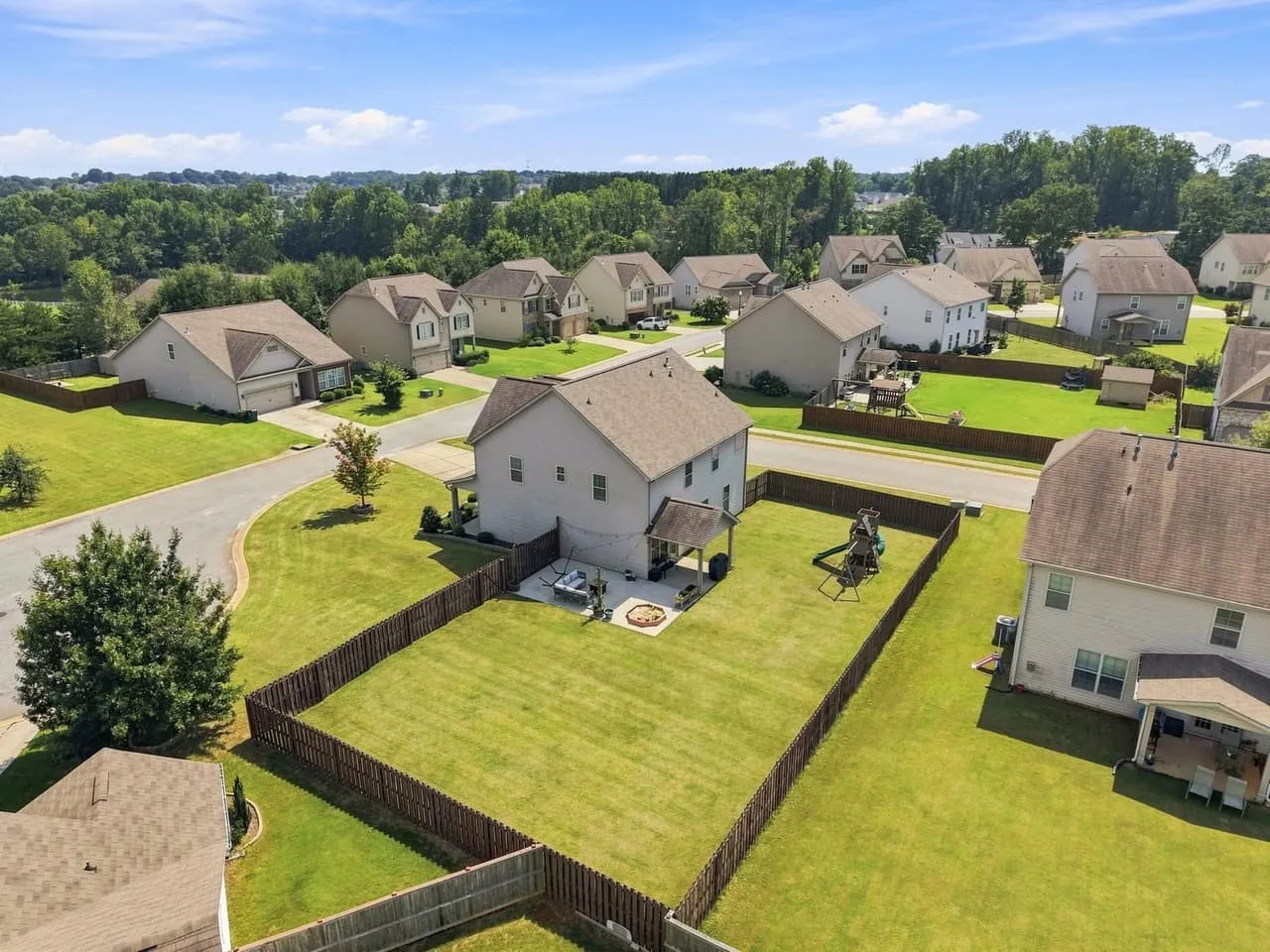
Three frames carry the listing.
The context frame runs roughly 150 to 200 feet, angled back toward the house, with enough street and enough neighbors in it to read as a real place. On a clear day up here the Blue Ridge sits on the horizon behind the rooftops. That’s a genuine selling point and it costs nothing extra to include.
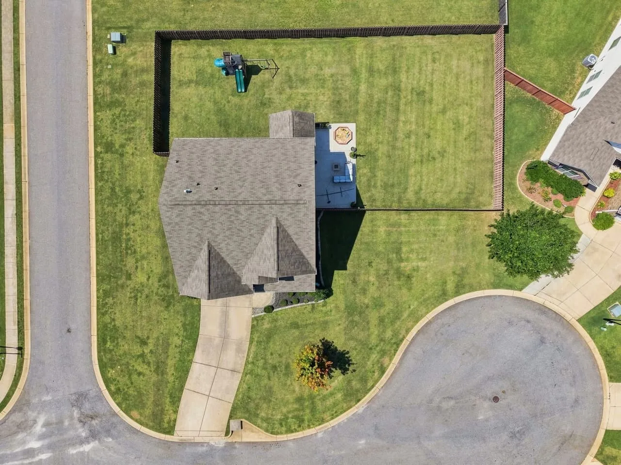
The lot frame is shot close to straight down, from lower. It’s the least glamorous photo in the set and often the most useful, because it draws the fence line for the buyer instead of making them guess at it. Agents underestimate how much argument this one photo prevents.
The approach frame looks down the street toward the house. It tells a buyer what the drive in feels like, whether there are sidewalks, how built out the section is. For anybody shopping from out of state this one does the most work, and it’s the one most often left out.
Past those three you’re photographing the same roof at slightly different altitudes. More isn’t better, and a bloated aerial set shoves your interiors further down the scroll.
When to skip it
An aerial is an honest photograph, and honesty isn’t always what the listing needs. A power easement behind the lot, a half-built section or a small lot the house mostly covers are all reasons to spend the money elsewhere. We’ve put the full list in our guide to which South Carolina listings need aerials, including what to spend it on instead.
The airspace part, which is a real constraint in the Upstate
Drone work for pay needs an FAA Part 107 certificate, so ask to see it. The FAA’s airmen inquiry lets you look a pilot up by name in about a minute, and a pilot who hesitates has told you something. Some brokerages also want proof of insurance, so ask early if yours does.
The practical problem is the airspace. GSP sits almost exactly between Greenville and Spartanburg, and addresses near Greer, Duncan and Lyman can fall in the controlled airspace around it. Donaldson Field south of Greenville has its own. How the FAA grid and LAANC work, and what a zero-ceiling square means, is in our hiring guide.
So ask before you book, not on shoot day. If an address needs a manual authorization, that’s a scheduling problem with a known fix, as long as somebody catches it early. If nobody checks, it becomes a photographer standing in your seller’s driveway explaining why he can’t fly.
Timing, and why aerials don’t follow the golden hour rule
For ground exteriors we’re usually chasing late light. Aerials want the opposite. From 150 feet you want the roof and the yard lit evenly and the grass reading green, and a low sun at six in the evening throws long shadows that drop half the backyard into the dark. Mid morning to early afternoon on a clear day is the reliable window.
Summer works against you here. Afternoon haze builds along the corridor and takes the hills right off the horizon, so a 9am slot in July buys you cleaner air than a 4pm one. Wind is the other scheduler. Most listing drones are rated for wind somewhere in the low to mid 20s mph, and gusts well below that can still soften frames while the aircraft holds position.
Mid October through early November is the best stretch of the year for this. Drier air, the Blue Ridge actually showing up behind the rooftops, and grass that still has color in it. A seller listing in that window gets aerials that look better than the same house would have looked in August.
Where the aerial goes once the listing is live
Not first. Photo one should almost always be your strongest ground exterior, because that’s the image a buyer uses to decide whether the house earns another second of attention. The aerial belongs at two through five, once they know what they’re looking at.
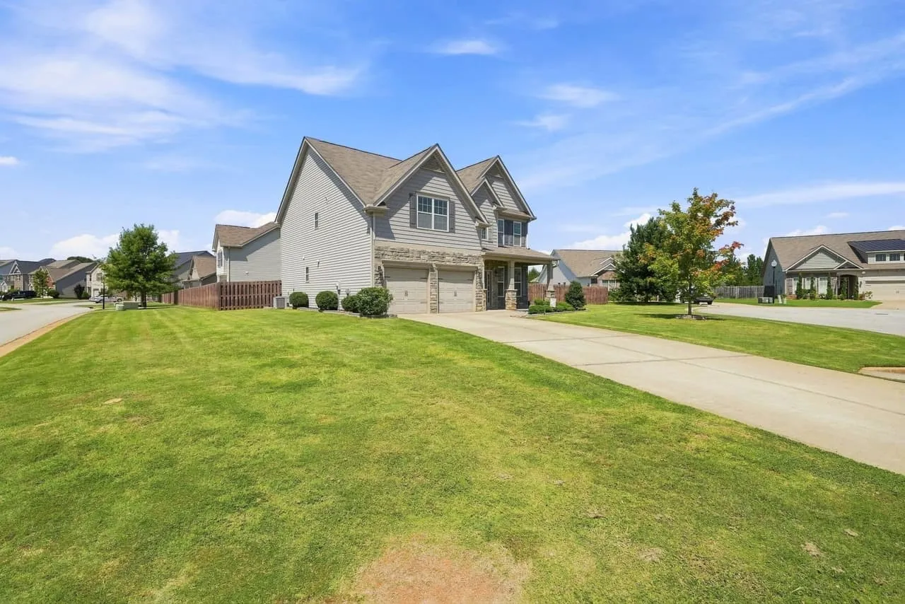
Aerials also travel further than anything else in the set. They’re the natural opening shot of a listing video, they hold up as a reel cover, and the aerial is often the photo a relocating buyer texts to their spouse. Which is the argument for planning them alongside the rest of the listing photos rather than deciding at the door. Our guide to timing the light on Upstate exteriors covers the ground-level half.
If you want to know whether a specific address sits in controlled airspace before you commit a seller to a date, call Beyond All Media and we’ll check the grid for you, or book a shoot. South Carolina (864) 714-0724 or Richmond (804) 913-3013.